PFPS Google Earth Tool
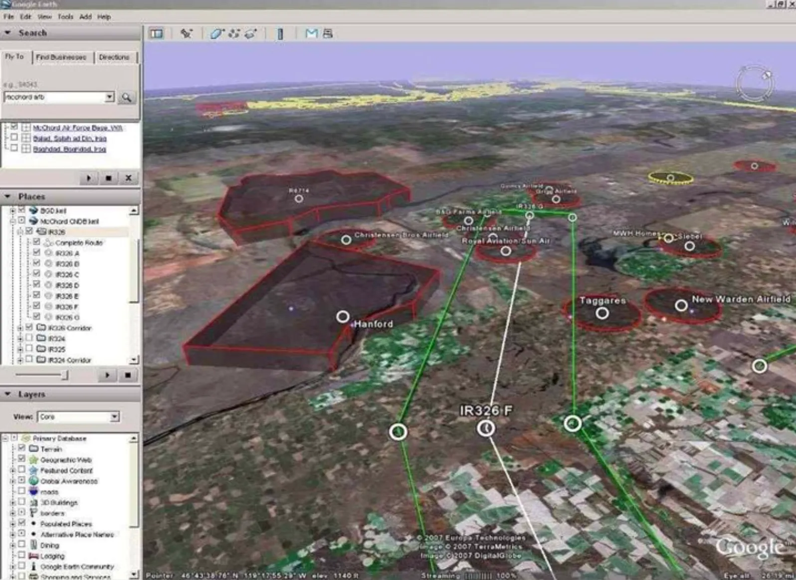
The project seems quaint now, but in 2008—seven years after Google had released Google Earth—DoD flight mission planning tools still could not interface with it. As a young Captain flying C-17s, I saw the opportunity in using Google Earth to visualize and rehearse flight plans… especially low-level routes, flown as low as 300 feet.
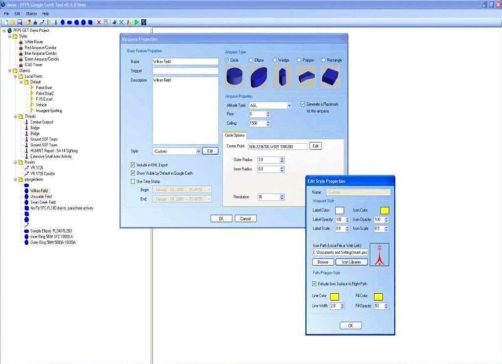
I wrote PFPS Google Earth Tool in C# and .NET during my free time. The utility allowed a user to import data from the PFPS planning suite, as well as create custom airspace regions, placemarks, and other types of visualizations, then export them into KML or KMZ files. Three versions became widely used in the DoD and caught the attention of Warfighter’s Edge, a software development team at the U.S. Air Force Academy. They took over the project and later included its functionality in a new tool called Wedge Viewer.